The maddening screw ups have made it easy to forget that the $1.8 billion Valley Line Southeast LRT is an investment in walking. Since each transit trip starts and ends with a walk or roll, the line is supposed to put pedestrians and people using mobility devices first. The magic of the sleek, Europe-proven Bombardier trains the City of Edmonton bought is their low floors. They make walking or rolling off a street or sidewalk and onto the train easy. Another bit of magic is that we’ve run this line along our streets, not adjacent to them. This has allowed stations to be knit into neighbourhoods. Both of these design features contrast with those of Edmonton’s legacy LRT lines, which use large trains that need big elevated platforms and stations. At best, these are difficult to walk into and out of, especially if you need a wheelchair; at worst, you can feel trapped and unsafe once within them.
So how good are the Valley Line’s stations to walk to and from? It’s a question as yet unanswered. Indeed, Edmonton’s conversation on the Valley Line has focused on mysterious car-sized chunks of concrete, why the line didn’t have more elevated track (thank heavens it didn’t, given all the cracked pillars), or the lack of transparency the public-private partnership creates. But the money the City spent was aimed at creating walkability and its positive side effects, which is investment in new housing and shops. That’s what my hometown of Kitchener-Waterloo has done with its 19-station, low-floor LRT. That system opened in 2019 and has revolutionized the city’s downtown core and sparked more than $3-billion in residential and commercial development. Why? It’s really walkable.
To find out how good the Valley Line is, or isn’t, at what we actually spent billions for it to do, I met up with Stephen Raitz, the chair of Paths for People. We biked to four of the line’s 12 stations and walked around. Here’s what we saw and what Raitz had to say.
Station: Churchill
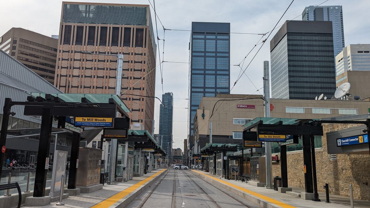
“Visually, the sightlines are pretty clear, which is good,” Raitz says, as we stand at Churchill Square and peer south, into the new, open-air Churchill LRT station. Across the track is the Stanley A. Milner Library, a bike lane, and a lane that originally was designed to be a one-way car lane but saw enough demand from people that city council caved and allowed it to be trialled for pedestrians only.
Raitz says there’s infrastructure within the station, like benches, garbage cans and ticket machines, but you can see across most of it. “Sightlines are really important because if I get out of City Hall it’s like, ‘Oh, this is where the LRT is.’ Or for people engaging with it for the first time, it’s less stressful. From inside the station it’s important, too, because it broadens the passive surveillance. You’re not feeling like you’re all alone. It’s not like being in the LRT stations that are underground downtown, where if you’re down there by yourself, nobody can see you.”
Most of the station scores well on sightlines for Raitz, but there are a few issues. “Right here, there’s no permeability,” he says, pointing at garbage cans and benches arranged to essentially make a wall roughly five metres wide. “That lessens the access people have in and out. I also think from a walking and especially rolling perspective that some of the built bits narrow the passageways, so that’s a count against.”
Another mark against? There’s a glass wall between the station and the library. For Raitz, it’s an example of overbuilding the station to allow drivers to remain on the street. The barriers to walkability had to be created to allow for drivers. Without the car lane, Raitz says, the station could evolve to become more walkable than it currently is. “You can’t access it from the library. If the goal was walkability, extending those trips, even though they may feel small from a distance perspective, from the experience it still feels like a lot of other walks in Edmonton, which means I’ve got to go around a maze of stuff to get where I need to go.”
Station: Strathearn
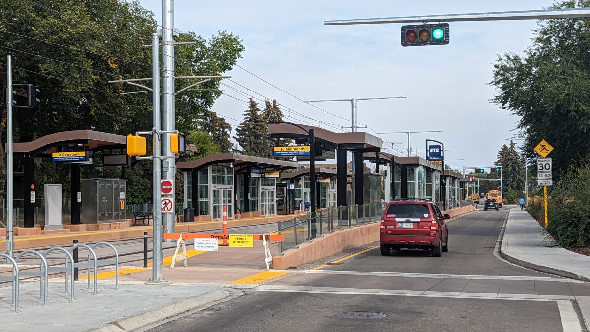
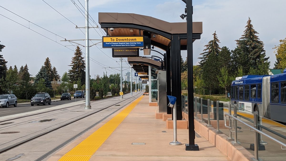
The Strathearn station is nestled into 95 Avenue and surrounded by a 1970s walkup apartment building, a community park, a local shopping strip that oozes the smell of fried chicken and church spires. It’s vaguely European – except when you look at the details. For one, there’s nowhere to bike aside from the sidewalk or street, despite the extensive bike racks at the station. For another, the station is like an island set in the middle of two lanes of vehicle traffic that run east and west, known in planning circles as centre justification. This forces a pedestrian to enter at four set spots rather than wherever they please.
“This one feels a little less tight overall compared to Churchill,” Raitz says. “This has walls on both sides so the access is more limited but the car infrastructure is here more permanently and this would be a tougher street to close down [to drivers]. The centre justification is interesting. I think it’s a limiting factor.”
Raitz points at a field connected to a nearby school on the south side of the station. “This is a field and it has only so much utility. Stripping off a couple additional metres [of the field] to really give this LRT more space and potentially have a shared-use path on either side …”
Raitz stops mid sentence. Before he can finish his thought, a person on an electric scooter whirs past on the sidewalk, even though the LRT isn’t running.
“That’s the kind of mobility that’s going to be here … and there’s another scooter down there!” he says, pointing. “But there’s no space for them.”
Station: Bonnie Doon
Full disclosure: I live in Bonnie Doon and moved here to use the LRT. So I bring some lived experience of using the pedestrian areas, or lack of them, when moving around the LRT station, which is set just to the east of Bonnie Doon Shopping Centre, Edmonton’s first but currently decaying mall.
Raitz and I cross 83rd Street, which the train runs along, and have a look.
“We’ve just crossed the intersection where the sidewalks don’t align super well, and I think this is a good example of transportation engineers thinking, ‘Oh, people need some kind of indicator to take the exact path they’re going to take,” Raitz says. He points to barriers and obstructions put in place to prevent pedestrians from walking logical paths. These also obstruct sightlines. “In some ways we’ve overbuilt things. It’s not that complicated.”
The station brought with it a shared-use path on both sides of 83rd Avenue, each encased with a fence, but only the west side of the street sees its path continue all the way to the LRT station, making the east side – the edge of the Idylwylde neighbourhood – have nothing but a narrow sidewalk and multiple car lanes.
“If the path was [also] on the other side, you’d have people in the apartment buildings being able to get directly onto a shared-use path,” Raitz says.
For the 5,000 or so people who live in Bonnie Doon, there’s also no direct way to walk to their eponymous station that doesn’t include walking across the mall’s gigantic parking lots, hoping drivers see you.
“We placed the LRT for maximum utility in the long-term because then we can redevelop this whole site, but that’s going to take eons,” Raitz says. “So why not support the [walking and rolling] that already exists and allow this site to evolve around existing vitality?”
Station: Avonmore
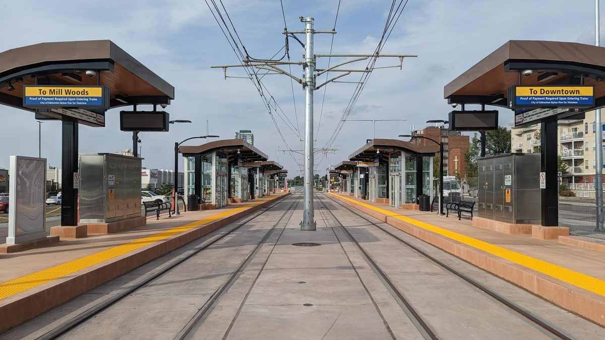
This station has been a game-changer for 83rd Street. It is now a nice, serene, low-stress street to walk along.
“Overall this station is good,” Raitz says. “It limited the width of the road. It calms traffic and tells it where it’s supposed to go. You already hear of the neighbourhood appreciating that.”
Still, there are a few details that Raitz questions, especially where the station interacts with the street at the intersection. The crosswalks to the station are set back several metres, instead of having more direct connections, he says. The intersections are oversized for drivers, and mean you stand in the station peering at a void of asphalt that, were a driver to lose control, would make you a bowling pin for them. “Just pour more concrete there to give a different visual signal for drivers and make the space focused for people, a little more cozy,” Raitz says. “This is like … I’m right against a road.”
In future, he says this station will see users jump across the hedges put in place to prevent them from walking wherever they please and suggest design tweaks that could be made to make it work even better. “We’ll see desire lines through those bushes and though things are overbuilt right now, over time we might see things pulled back a bit, you might see some of the barriers come down.”
Savvy AF. Blunt AF. Edmonton AF.

